
Offer
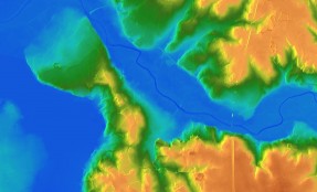
Cartography and GIS
Cartography focuses on modeling of spatial information and its visualization while GIS is a system for collection, processing and analysis of digital spatial data.
Terramap through ...
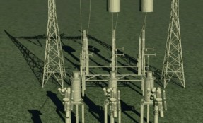
Engineering: surveys, monitoring, modeling
Modern engineering, especially in terms of civil and construction works is based on precise surveying measurements.
Terramap by combining the latest surveying techniques, digital photogrammetry and ...
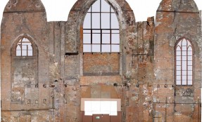
Heritage and architecture
Terramap provides architectural inventory and prepares professional survey documentation. Our team can proof several years of experience in the implementation of national and international heritage documentation ...
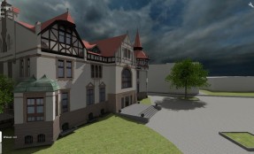
Augmented Reality
Terramap offers digital three-dimensional modeling based on direct measurements or existing documentation (concepts, maps, technical drawings).
Having 3D model of an object we can virtually change ...

Surveying engineering
(Polski) Nasza kadra geodezyjna to doświadczeni fachowcy po Akademii Górniczo Hutniczej w Krakowie, jednej z najbardziej renomowanych uczelni w kraju. Zespoły nasze realizowały obsługę dużych, średnich i małych inwestycji w Polsce i Europie, mamy również doświadczenia w pracy na budowach w krajach arabskich…. Continue reading
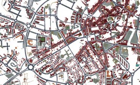
GIS
Our main offer in the field of GIS is providing of high quality vector and raster data with accompanied attributes or database which are the main layers of any GIS. Continue reading
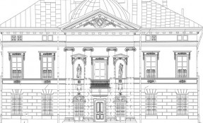
Architectural inventory
We have created and still developing our own software and equipment solution. This enables us to offer a wide range of services dedicated to architects, art restorers, archeologists, museums and the quality of our products meets the highest expectations. Continue reading