
Cartography and GIS
Cartography focuses on modeling of spatial information and its visualization while GIS is a system for collection, processing and analysis of digital spatial data.
Terramap through synergy of GIS and cartography offers not only geospatial data, but also the tools and methods to manage data and optimize daily processes.
In the field of digital cartography and GIS we offer:
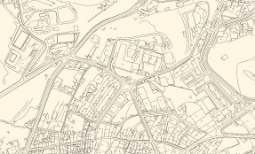
Vector mapping (planimetry)
As a source data for creation of vector maps Terramap uses stereo pairs of aerial photographs, aerial and terrestrial laser scanning, direct surveying or archive raster. Continue reading
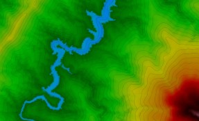
DTM and DSM
Digital Terrain Model (DTM) as digital representation of the portion of the Earth’s surface is the source of a number of geospatial analysis and calculations. Continue reading
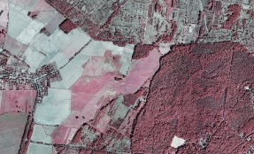
Orthophotomaps
Orthophotomap is generated by mathematical transformation of aerial image into mapform. Camera calibration data , image orientation parameters, terrain height model and ground control points are being used to remove lens distortion… Continue reading
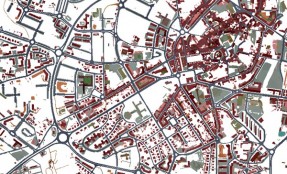
GIS
Our main offer in the field of GIS is providing of high quality vector and raster data with accompanied attributes or database which are the main layers of any GIS. Continue reading